North-west · Navagio and the North-West
Can You Visit Navagio Beach? Current Status
Last checked Next recheck due late May 2027, when the annual decision is re-issued.
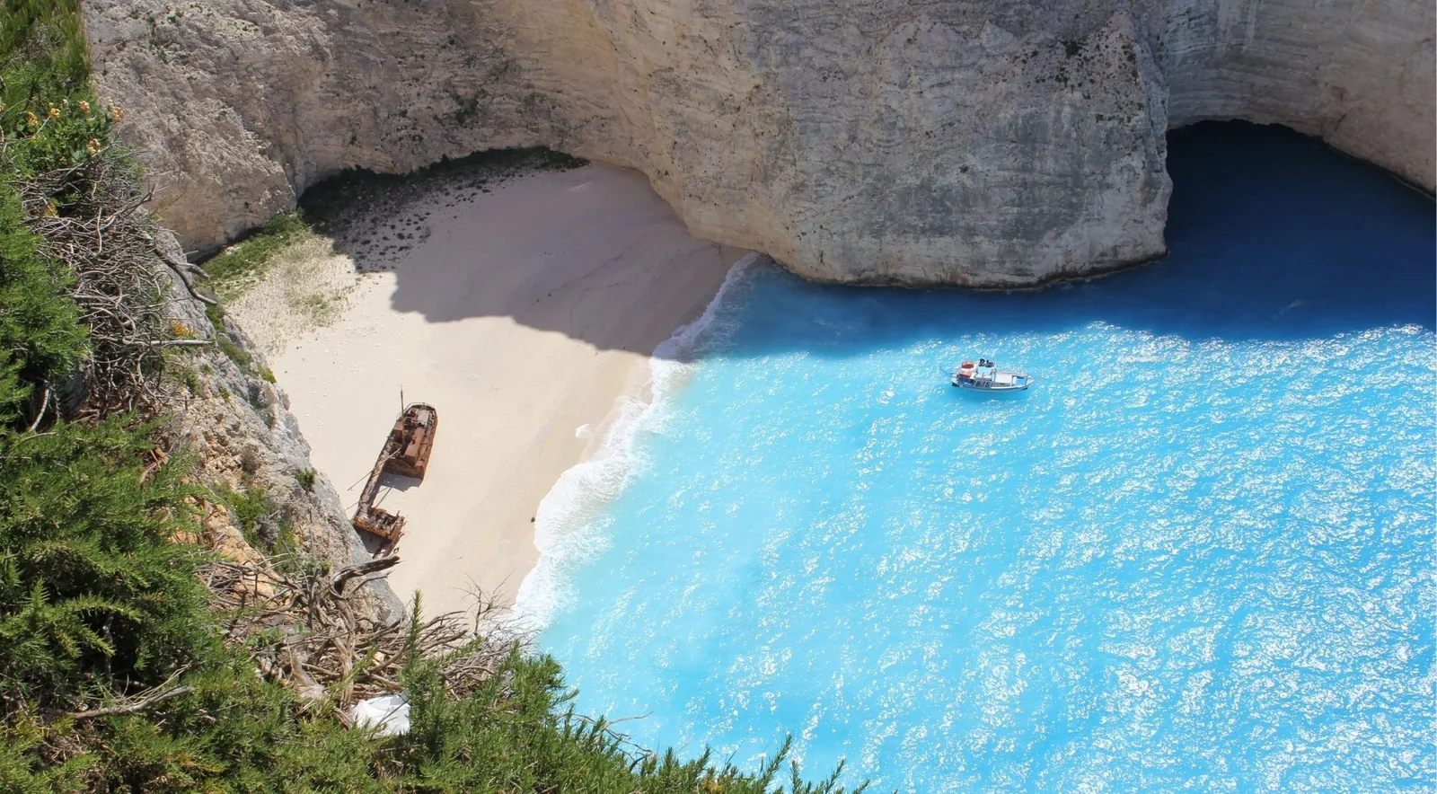
This page exists because the answer changes every year and almost every other page about Navagio is out of date. It is rechecked each May, when the new decision is published.
At a glance
- Surface
- gravel
- Access
- Level 5 of 5
- Parking
- Not applicable
- Sunbeds
- NO
- Taverna
- NO
- Toilets
- NO
- Lifeguard
- No
- Blue Flag 2026
- No
- Step-free access
- No
- Marine Park
- Outside the park
- Greek name
- Ναυάγιο
- Coordinates
- 37.85955, 20.62494
Official figures: Closed - 50 m exclusion zone for vessels and swimmers and no landing anywhere on the shoreline, renewed annually since 2023
What you can and cannot do in 2026
The 2026 decision names two zones — a Prohibited Zone and a Controlled Access Zone — mapped in an annex derived from an OASP risk assessment dated 28 April 2026. In plain terms:
You may approach by boat and stay outside the 50 m line, photograph the wreck from the water, and stand on the clifftop platform above the bay.
You may not land anywhere on the shoreline by any vessel, swim inside the line joining the two ends of the bay, or walk onto the beach from any direction.
Enforcement is by the Hellenic Police, and the penalties are administrative sanctions under a 1973 legislative decree.
Why it is closed
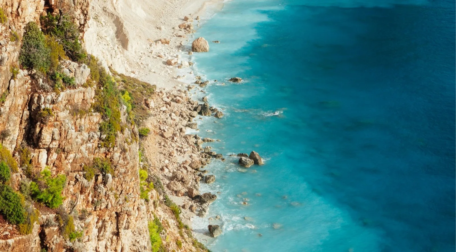
The cliffs above the beach are actively failing. That is not a precaution invented for the tourist season: the closure has been renewed every year since 2023, each time on a fresh risk assessment, and in the meantime a 57-year-old Polish visitor died swimming in the bay in August 2025.
The geology explains why this will not simply resolve. The west coast of Zakynthos is hard, fractured Upper Cretaceous limestone that stands in 200 m cliffs and fails as rockfall rather than eroding gradually. It supplies almost no sediment, which is also why the beach is limestone gravel rather than sand.
The 50 m figure, and the 40 m you may be told
The decision says 50 metres, for vessels and swimmers alike. A boat owner told Ermis News in July 2026 that operators are held to 40 metres “as given to us by the Port Authority”. Both statements appear to be true: paragraph 2(b) of the same decision lets the Port Authority define its own separately marked safe zone, which is the likely explanation for the gap.
This site publishes 50 m as the decree figure and records the 40 m operational figure rather than pretending the discrepancy does not exist.
What the boat trips actually deliver
Every “Shipwreck Beach” trip sold on Zakynthos is now a photo stop. Some operator pages have not caught up with their own itineraries: one currently states “Photo stop at Shipwreck Beach” in the itinerary and “direct access to Shipwreck Beach” in its testimonial block, on the same page.
If seeing the wreck is the point of the trip, the shortest crossing is from Porto Vromi on the west coast — 4.22 km, against 13.66 km from Agios Nikolaos in the north, which has to round the cape. The Blue Caves are the reverse: 0.43 nautical miles from Agios Nikolaos and 6.49 from Porto Vromi. Go west for Navagio, north for the caves.
The plan to extend the beach
A tender published on 8 July 2026, worth €3,870,967.74 plus VAT, would place roughly 45,000 cubic metres of sand and gravel to push the sea back about 30 metres and shield the hull, which now sits some 25 metres from the water. The coastal-engineering study was done pro bono by the National Technical University of Athens, and conservation of the wreck itself can only begin once the shoreline work is done.
It is not uncontested. The geologist Manolis Vasilakis argues publicly that the beach is not eroding and that the gravel would simply wash away.
Four seasons of closure
| Season | Instrument |
|---|---|
| 2023 | FEK B’ 2290/2023, amended B’ 2477/2023 |
| 2024 | KYA 8439/2024, FEK B’ 2653/02.05.2024 |
| 2025 | FEK B’ 2642/29.05.2025 |
| 2026 | FEK B’ 3033/28.05.2026 |
Each instrument expires on 31 October and is re-issued the following May. That pattern is the reason this page carries a recheck date rather than presenting itself as permanent.
Nearby beaches
Ordered by measured driving time, not by distance along the shore — on this island the two rarely agree.
- Porto Vromi 23 min The nearest embarkation point — but note there are two coves of this name.
- Navagio viewpoint 15 min The clifftop platform, which is open.
- Porto Limnionas 45 min If you want to actually swim on this coast.
Navagio access: common questions
Dated answers. This page is rechecked each May, when the annual decision is re-issued.
No. FEK B' 3033/28.05.2026 closes it to visitors from land and sea until 31 October 2026. It is the fourth consecutive season it has been shut.
No. Swimming is prohibited inside the line joining the two ends of the bay, and no vessel may land on the shoreline. A 57-year-old visitor died swimming in the bay in August 2025.
The decision says 50 metres from the shore, for vessels and swimmers alike. Operators are reported to work to 40 metres, which paragraph 2(b) of the same decision allows the Port Authority to mark separately. Treat 50 m as the published figure.
Yes, and they are worth doing — but as a photo stop. Every trip sold as “Shipwreck Beach” now circles the bay. If an operator's page implies you will land, its itinerary almost certainly says photo stop.
Yes. The clifftop platform above the bay is open and is the only way to see the cove from land. It closes on Red Code fire-risk days, with a €300 fine for entering. There are no toilets there. See the beach page for the access road.
The cliffs above it are actively failing, and each annual closure rests on a fresh risk assessment — the 2026 one is dated 28 April 2026. The west coast is hard limestone that fails as rockfall rather than eroding gradually.
Nothing published commits to a date. A €3.87 million plan to extend the shoreline 30 m seawards was tendered in July 2026, and conservation of the wreck can only begin after that work. The closure has been renewed four years running.
Still have questions? Email us at info@zakynthosbeaches.com
What we could not establish
- Whether the 20-minute maximum stay still applies. The Zakynthos Harbour Master's decision of 12 June 2023 set a 50 m limit and a 20-minute cap on time inside the bay, with no anchoring. Whether that instrument was renewed for 2026 is unclear. The Port Authority would settle it.
- When the beach might reopen. Nothing published commits to a reopening date, and the closure has now been renewed four years running. The nourishment works must finish before the wreck itself can be conserved. Watch for the FEK issued each May.
Sources
- FEK B' 3033/28.05.2026 — the 2026 joint ministerial decision, as reproduced with the gazette text by aftodioikisi.gr, 2 June 2026, cross-checked against CNN Greece citing ERT, 1 June 2026.
- Enabling law: art. 68 of L.4875/2021 as added by art. 268 of L.5037/2023. Penalties under art. 157 of Legislative Decree 187/1973.
- Tender for the shoreline works, published 8 July 2026; programmatic agreement signed 28 January 2026.
- Ermis News, 21 July 2026 — boat operator on the 40 m working distance.
Where it is
Navagio (Shipwreck Beach) sits on the northwest coast, in the Navagio and the North-West cluster. Open it on the map to see what else is within a short drive.
Getting to the water
Boat trips around the island
Some of the best-known places on Zakynthos have no road to them — Navagio, the Blue Caves, Marathonisi. A boat is not an upgrade to those; it is the only way in.